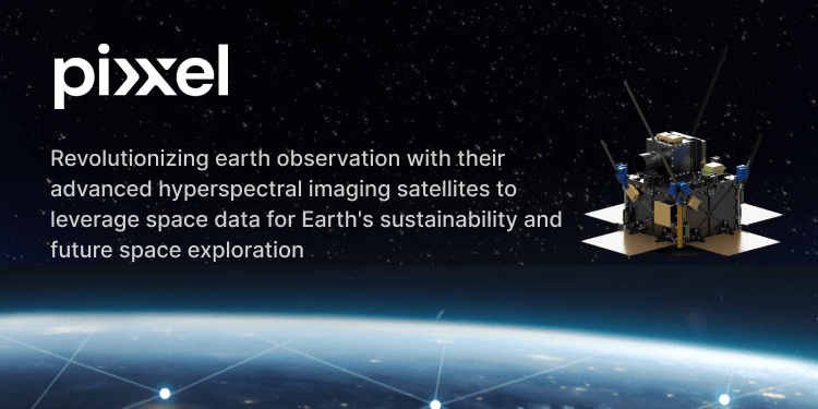
Pixxel, a visionary space data company headquartered in India, is transforming global earth observation capabilities by building a constellation of hyperspectral earth imaging satellites and the analytical tools to mine insights from that data..
This innovative technology promises to unveil unprecedented insights into our planet’s health, resources, and environmental dynamics, marking a significant leap forward in the field of space-based remote sensing.
Founded by Awais Ahmed and Kshitij Khandelwal, Pixxel has quickly emerged as a trailblazer in the space industry.
The company’s mission is clear: harness the power of advanced satellite imaging to tackle some of the most pressing challenges facing humanity today, including climate change, resource management, and disaster response.
Unveiling Unseen Realities
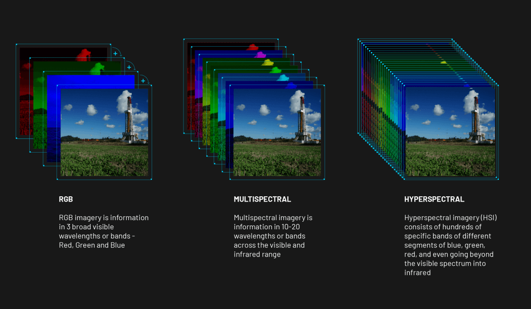
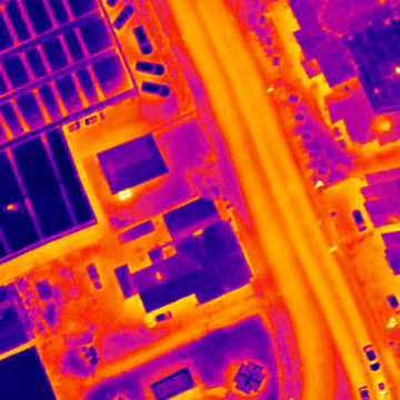
At the heart of Pixxel’s innovation lies hyperspectral imaging (HSI), a revolutionary technique that captures and analyzes light across hundreds of spectral bands.
Unlike traditional satellites that rely on RGB (Red, Green, Blue) or multispectral imaging, Pixxel’s satellites can discern detailed spectral signatures, providing a wealth of information previously inaccessible.
This capability enables Pixxel to monitor and analyze diverse environmental phenomena with unparalleled precision.
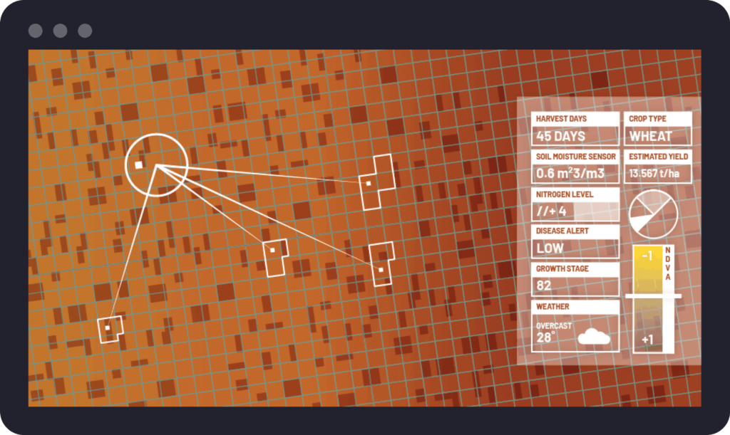
The constellation of Pixxel’s hyperspectral satellites is designed to achieve daily global coverage, with a revisit rate of every 24 hours.
This frequent data capture ensures near real-time monitoring of dynamic processes such as crop health, land use changes, and natural disasters.
Applications Across Industries
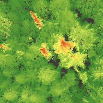
Agriculture:

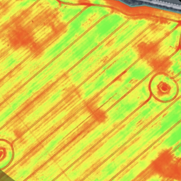
Pixxel’s satellites enable daily coverage of vast areas, providing current data throughout the growing season.
They distinguish between crop species and weeds, identify nutrient deficiencies with advanced spectral analysis, and offer field-level insights to monitor crop health dynamics.
Additionally, Pixxel forecasts pest infestations and detects crop diseases preemptively, supporting proactive agricultural management strategies.
Energy:

Pixxel’s satellites excel in detecting chemical seepages and oil slicks across diverse land types. They accurately pinpoint hydrocarbons, aiding in the discovery of new reserves for exploration.
Additionally, Pixxel monitors vegetation stress near pipelines and quantifies pollution levels from pipeline leakages, ensuring proactive environmental management in the energy sector.
Environment:

Pixxel’s satellites map and monitor forest cover, facilitating efforts to combat deforestation. They assess climate risks like flooding, famine, and wildfires, providing critical data for disaster preparedness.
Pixxel tracks natural capital utilization, enhancing economic and ecological sustainability planning.
Additionally, the satellites detect hazardous materials promptly, enabling proactive measures to mitigate environmental risks, and monitor water resources to ensure sustainable management practices.
Government Services:

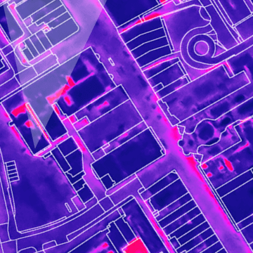
Governments benefit from Pixxel’s satellites by gaining access to timely insights for urban planning, infrastructure development, disaster response, and environmental regulation.
The ability to monitor changes in land use, infrastructure projects, and natural disasters enables governments to plan and respond effectively to emerging challenges.
Mining:

In the mining industry, Pixxel’s hyperspectral satellites offer invaluable support by mapping mineral deposits, analyzing geological structures, and assessing environmental impacts.
By providing detailed mineralogical data and identifying potential mining sites, Pixxel contributes to sustainable resource extraction practices.
Technological Advancements
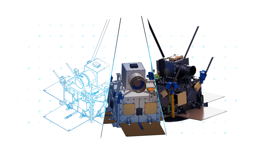
Pixxel’s hyperspectral small satellites boast up to 250 spectral bands, enabling them to capture detailed information about Earth’s surface and atmosphere.
With a spatial resolution of 5 meters, Pixxel’s imagery provides unprecedented clarity and accuracy, essential for applications requiring fine-scale analysis.
The company’s data platform complements its satellite capabilities by offering advanced image processing, machine learning algorithms, and multi-dimensional visualization tools.
This integrated approach allows users to extract actionable insights from Pixxel’s vast repository of geospatial data swiftly.
Vision for the Future
Looking ahead, Pixxel envisions expanding its hyperspectral imaging capabilities beyond Earth to explore resources within our solar system.

By identifying and characterizing celestial bodies and potential space resources, Pixxel aims to support future space missions and enable sustainable space exploration.
Conclusion
Pixxel’s commitment to innovation, sustainability, and global impact underscores its leadership in the space industry.
By leveraging hyperspectral imaging and advanced data analytics, Pixxel not only revolutionizes Earth monitoring but also paves the way for a future where space-based technologies contribute to sustainable development and environmental stewardship on a global scale.
As Pixxel continues to expand its constellation and enhance its technological capabilities, the potential for transformative applications across industries and disciplines grows exponentially.
With a focus on accessibility, reliability, and innovation, Pixxel is poised to shape the future of space-based remote sensing, driving positive change for our planet and beyond.